Sharpening Antarctica’s image

I like Google Earth. I like looking down on my neighbours to see what’s going on behind their shelter belts, and because I like monitoring what’s going on at the poles, I have the National Snow & Ice Data Centre’s overlay switched on most of the time. It shows current sea ice extent, snow cover and so on. But when I swoop over Antarctica, the underlying images provided by Google are rather disappointing – low resolution and distorted. I was therefore very pleased to discover that a collaboration between NASA, the US Geological Survey, the National Science Foundation and the British Antarctic Survey has created a new map of the continent based on Landsat imagery. From NASA’s press release:

The map is a realistic, nearly cloudless satellite view of the continent at a resolution 10 times greater than ever before with images captured by the NASA-built Landsat 7 satellite. With the unprecedented ability to see features half the size of a basketball court, the mosaic offers the most geographically accurate, true-color, high-resolution views of Antarctica possible.

You can play with the map at the USGS site, but the interface is rather clunky. However, there are hints that the new map will be available for Google Earth before long. Can’t wait….

More ice/less ice

PolarsternMore on the Arctic melt: the National Snow and Ice Data Centre updates its commentary on this year’s record ice minimum. As of yesterday, the five day moving average of ice was still moving downwards, but slowly. Their comment on the North West Passage is interesting.

The main, deep channel of the Northwest Passage (Lancaster Sound to M’Clure Strait) has been open, or nearly ice-free, for about five weeks (since August 11, approximately). Of note is the northernmost ice edge ever recorded, at 85.5 degrees North, near the 160 degrees east longitude line.

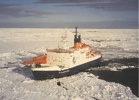
Meanwhile, the RV Polarstern (see pic), near to completing a voyage through the Arctic as a contribution to International Polar Year, reports that large areas of this year’s ice have only been 1m thick – a 50% reduction on only 6 years ago. When the ship got close to the pole, it started raining. Ursula Schauer wrote (in early September):

A whole day of rain within 150 km of the North Pole came somewhat as a surprise! For the past few weeks, one low-pressure system after another has continuously carried warm air from northern Siberia (15°C at the Lena estuary!) towards the central Arctic Ocean. In this way the sea ice disintegrates more and more right before our eyes.

Meanwhile, I’ve bet Stoat (aka William Connolley) that 2008 will beat 2007’s record low. But only £10…

Arctic carries on melting

Ice070911Compare this picture with the one accompanying my last post on this season’s record-breaking sea-ice melt in the Arctic Ocean. More ice has gone, and although the end of the melt season is fast approaching, this year’s low is already about one million square kilometres less than the previous minimum, set in 2005. The NSIDC’s most recent report (Sept 10) also demonstrates that an area of ocean about the size of California is ice-free for the first time since satellite observations began in 1979. As the ocean cools, it will give up heat to the atmosphere. This could delay the onset of the northern hemisphere winter – and perhaps mean a repeat of last year’s mild NH autumn and the late arrival of winter. In turn, this sets up the Arctic for another year of record low ice in 2008, leading to suggestions that the Arctic could be ice-free in summer long before the IPCC expected. From The Guardian [UK]:

Continue reading “Arctic carries on melting”

Back in harness

ChinaI bought one of Martin’s pork pies today. After too much yak in Shangri-La, I found myself lusting after something a little more in my own cultural tradition… But as I try to catch up with climate news, I find that Xian Ge Li La is in the news for all the wrong reasons:

KUNMING, September 10 — One of China’s leading tourist landmarks, Meili Snow Mountain, will be devoid of snow within 80 years if global warming trends continue, a meteorological scientist warned on Monday. Liu Jiaxun also said China’s lowest and southernmost glacier, Mingyong, has shrunk by at least 40 meters over the past 13 years. The combined effects of ice melting and drying water sources would have devastating effects downstream, said Liu, deputy director of the Meteorological Bureau of Diqing Tibetan Autonomous Prefecture, in northeastern Yunnan Province. Mingyong — at 2,700 meters above sea level and 28.5 degrees north — had the lowest elevation and latitude of all China’s glaciers, said Liu. At 11.7 km long and covering 13 sq. km, it was shrinking faster than any other Chinese glacier, he said.

Sadly, during my visit to the Diqing Tibetan Autonomous Prefecture the Himalayas were shrouded in cloud. It rained. (Picture from Erhai Lake near Lijiang). Catching up will continue soon.

[Update: Pictures of the Meili Snow Mountain and glacier from China View here. The clouds cleared briefly, apparently…]

Greenland: ice, water and diamonds

More news of melting ice from the top of the world. According to Marc Tedesco, lead author of a paper in the May 29 issue of the American Geophysical Union’s Eos:

“The sensors detected that snowmelt occurred more than 10 days longer than the average over certain areas of Greenland in 2006