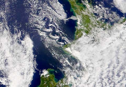
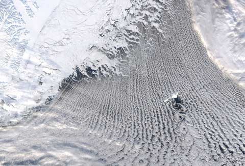
Not much of a climate connection here (though Greenland and sea ice are in the picture), but regular readers will know that I’m fond of looking down on the Earth from space. This image from NASA’s Earth Observatory shows a beautiful von Karman vortex street downwind of Jan Mayen island in the Greenland Sea (600 km N of Iceland, 500 km E of Greenland), surrounded by more conventional cloud streets running south off the sea ice. Click on the image for more detail, and check out the Wikipedia page for an excellent animation showing how the vortices form, and more pictures. We get them too: here’s a NASA satellite image from 2002 of a similar vortex street forming to the west of Mt Taranaki:

Normal climate service will resume shortly…
[Pet Shop Boys]


PSB? WtF!
Bono’s banned.
Why, what has he done?
Nice pic’s btw….I assume Taranaki is subject to a South-easterly. Uncommon I would have thought. A day of rest for the surfies,
did you ban Bono because you stole his words?
… or are you a ballet fan?
Stole? No, “fair use” covers it.
Sometimes it’s just nice to go for the less obvious choices…