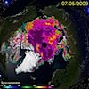
 The National Snow and Ice Data Centre (NSIDC) has just published its July sea ice news update on the state of the Arctic and the progress of the melt season. Under the heading Melt season in high gear, it gives an overview of June events, and the conditions at the start of the period of most rapid melt. Most interesting is their comment that weather patterns over the month were similar to those of 2007, when the record minimum was set:
This contrast between high and low pressure is broadly similar to the atmospheric circulation pattern that set up in 2007. In 2007, that pattern contributed to a significantly accelerated decline in ice extent during July, and a record minimum low in September. Will the same acceleration in ice melt occur this year? If so, a new record low minimum extent becomes more likely. So far, an acceleration has not been observed.
On the other hand, a peek at the IJIS graph shows that 2009 (red) has dipped below last year at the same time, and Cryosphere Today is showing large areas of ice break up (click on the thumbnail above for a larger version). CT’s metric (area, not extent) is also showing a steep decline. No sign of the fat lady yet…
