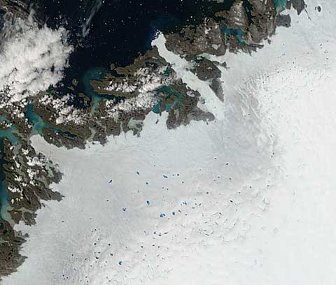
From NASA’s eyes in the sky, this is a view of the west coast of Greenland downloaded earlier today, looking down on the Ilulissat Icefjord — the outlet for the Jakobshavn Isbrae, the biggest outlet glacier in Greenland and the largest in the northern hemisphere. It’s the long tongue of white reaching up from right of centre to the top of the frame, where you can see the white dots of newly calved icebergs drifting out into Disko Bay (click on the picture to see the 250m/pixel original image at the MODIS site). All very interesting, of course, but I’m posting it to show the numerous large lakes of glacial meltwater that have appeared on top of the ice sheet over recent weeks. At the edge of the ice sheet, the winter snow has melted revealing the greyer ice underneath, but as you climb up the ice away from the coast you get back up into unmelted snow (bottom right). And there are lakes like this a very long way up the west coast, all primed to deliver their water down through moulins to the base of the sheet and thence out to sea, or over the surface in glacial rivers.
I hope this illustrates that there’s more to a melting Arctic than the sea ice — the rest of this post is catching up with sea ice news…

