
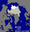
 The National Snow and Ice Data Centre announced today that this year’s Arctic sea ice minimum extent was likely to have been reached on September 12. It’s the third lowest minimum in the record, behind 2007 and 2008. The image at left shows this year in white, compared with 2007 in darker colours. From the report:
On September 12, 2009 sea ice extent dropped to 5.10 million square kilometers (1.97 million square miles). This appears to have been the lowest point of the year, as sea ice has now begun its annual cycle of growth in response to autumn cooling. The 2009 minimum is the third-lowest recorded since 1979, 580,000 square kilometers (220,000 square miles) above 2008 and 970,000 square kilometers (370,000 square miles) above the record low in 2007. The 2009 minimum is 1.61 million square kilometers (620,000 square miles) below the 1979 to 2000 average minimum and 1.28 million square kilometers (490,000 square miles) below the thirty-year 1979 to 2008 average minimum.
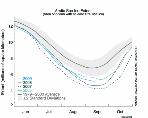
This NSIDC graph gives a very good idea of what’s been happening this year. 2009 has never looked much like beating 2007, but until mid-August it was giving 2008 a run for its money. However, a relatively cool summer and winds during August that dispersed the ice held the minimum extent above last year.
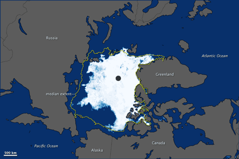
[Update 19/9] NASA’s Earth Observatory posts this graphic of the ice distribution on 12/9:
The usual suspects will no doubt trumpet this as a “recovery”, but the NSIDC team don’t think so:
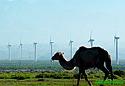 At least some Americans and Chinese are getting together to work on climate change. A team of researchers from Harvard University and Beijing’s Tsinghua University have been conducting a serious investigation into China’s wind power potential. Their work was the cover story for the Sep 11 issue of Science (sub required) and is reported in  the
  Sea level will rise by more than a metre by 2100 according to the authors of the third chapter in the World Wide Fund for Nature’s new Arctic report,
  The National Institute for Water and Atmospheric Research (NIWA) has bought a shiny